The recent clement weather (I was about to write “unseasonable” until I remembered that it is supposed to be summer, after all) has had me hankering to get out and about walking. This currently means a mile or so along the Tissington or Sett Valley trail before the Nipper starts to shout; however, in a previous life, good weather would mean a great day to get up on Kinder, which in my limited experience is one of the best places to be on a fine day, and therefore I thought I would share with you the walk which we might otherwise have done. For me, as a very amateur walker and hill climber, it ticks all the boxes: long enough to make you feel like you’ve done a decent walk without rendering you immobile the following day; a good balance of inclines and walks on the flat; spectacular views of the Peak District, Manchester and beyond, even to Wales; and, of course, a choice of hostelries at which to end.
Kinder Scout is not so much a summit as a sprawling high moor topping over 2,000 feet, thus making it the highest point in the Peak District. For those of you who care to don a pair of walking boots from time to time, you will be fascinated to learn, if you did not already know, that Kinder is the scene of the 1932 mass trespass, a sort of protest ramble which revolutionised access rights to the countryside, and this walks picks up part of the route taken by the trespassers. If you travel to Hayfield by car, you can park in Bowden Bridge car park and ascend the Kinder slopes by the trespassers’ original route, but I prefer to start this walk from Market Street.
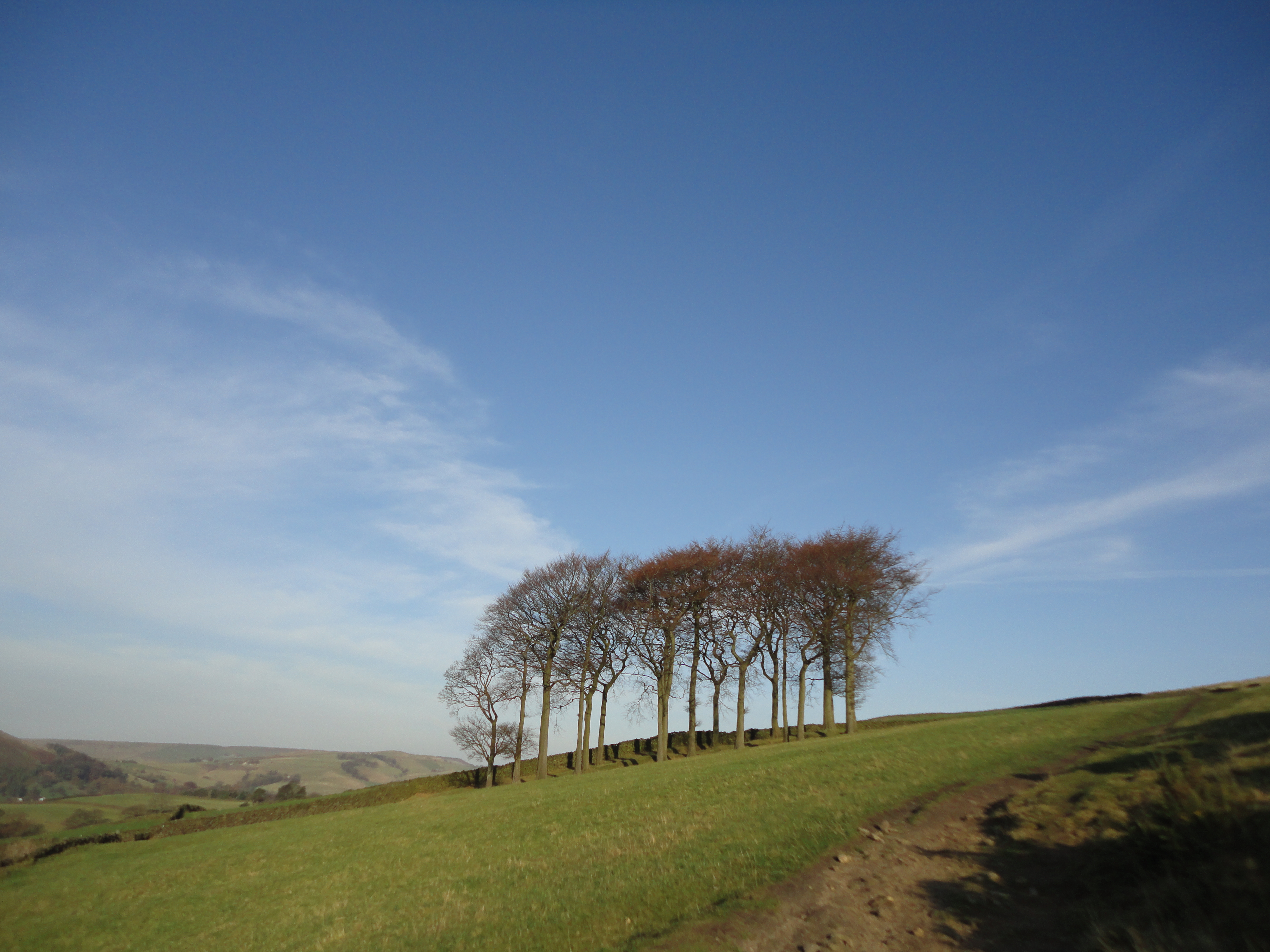
Pass the Packhorse pub, and veer up Kinder Road to the right of the Royal, passing the library, until you see a public footpath heading off to the left. This, if memory serves me rightly, is the Snake Path. Follow this uphill, through a number of kissing gates (which can usefully counter the marital rage that often overshadows the first half hour of any major walk as a result of heated exchanges over e.g. dog leads, sandwich choices, washing facilities at campsites, etc.), and past a copse known locally as Twenty Trees, although I believe there are only nineteen. Turn around here for great views of the village and Lantern Pike.
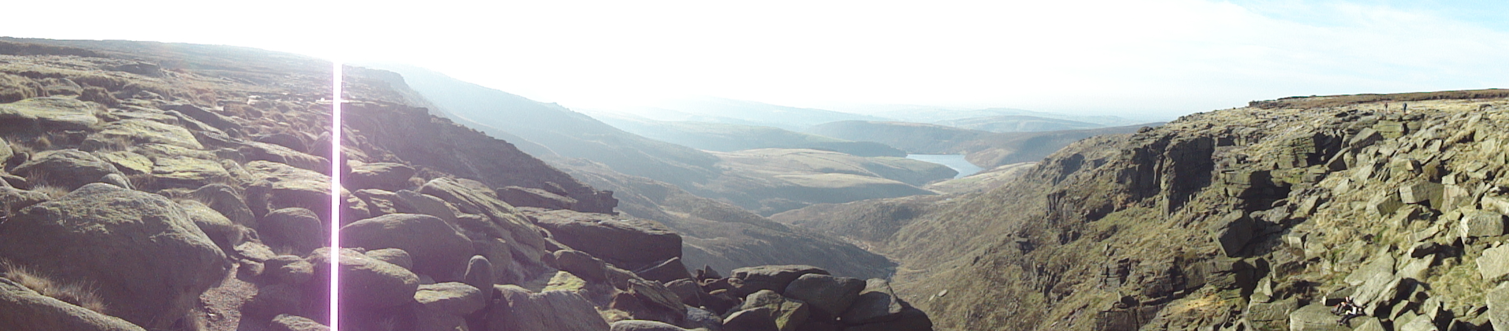
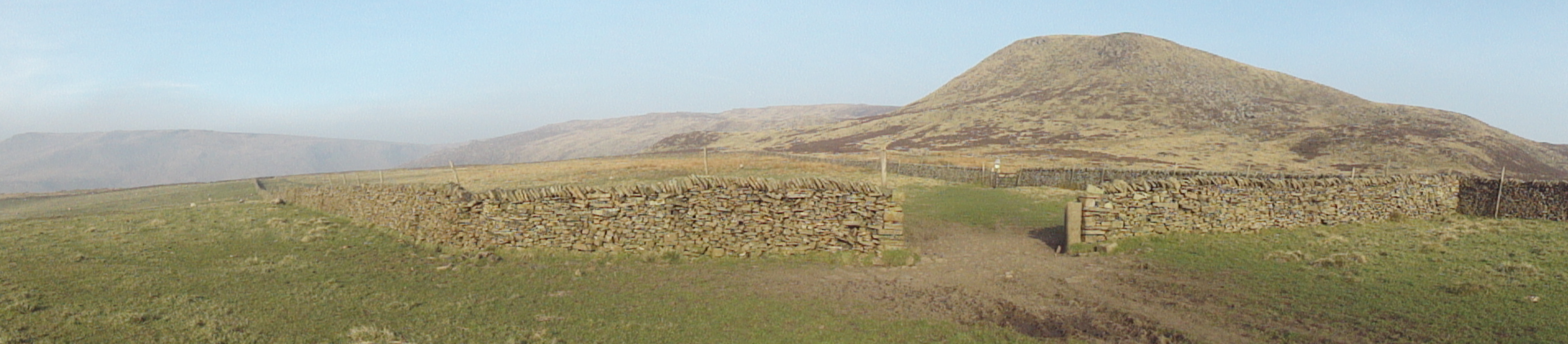
The path levels out after a short climb, and brings you into sight of Kinder and the shooting lodge. I really love it up here on the moorland grasses, with the ridges looming in the distance, and there are a variety of other walks you could take from this point over Middle Moor and/or down into Little Hayfield. For now, follow the path with the shooting lodge to your left, the reservoir down below to your right, heading off to the left end of the Kinder ridges.
Twenty Trees

Shooting lodge and Kinder from the snake path
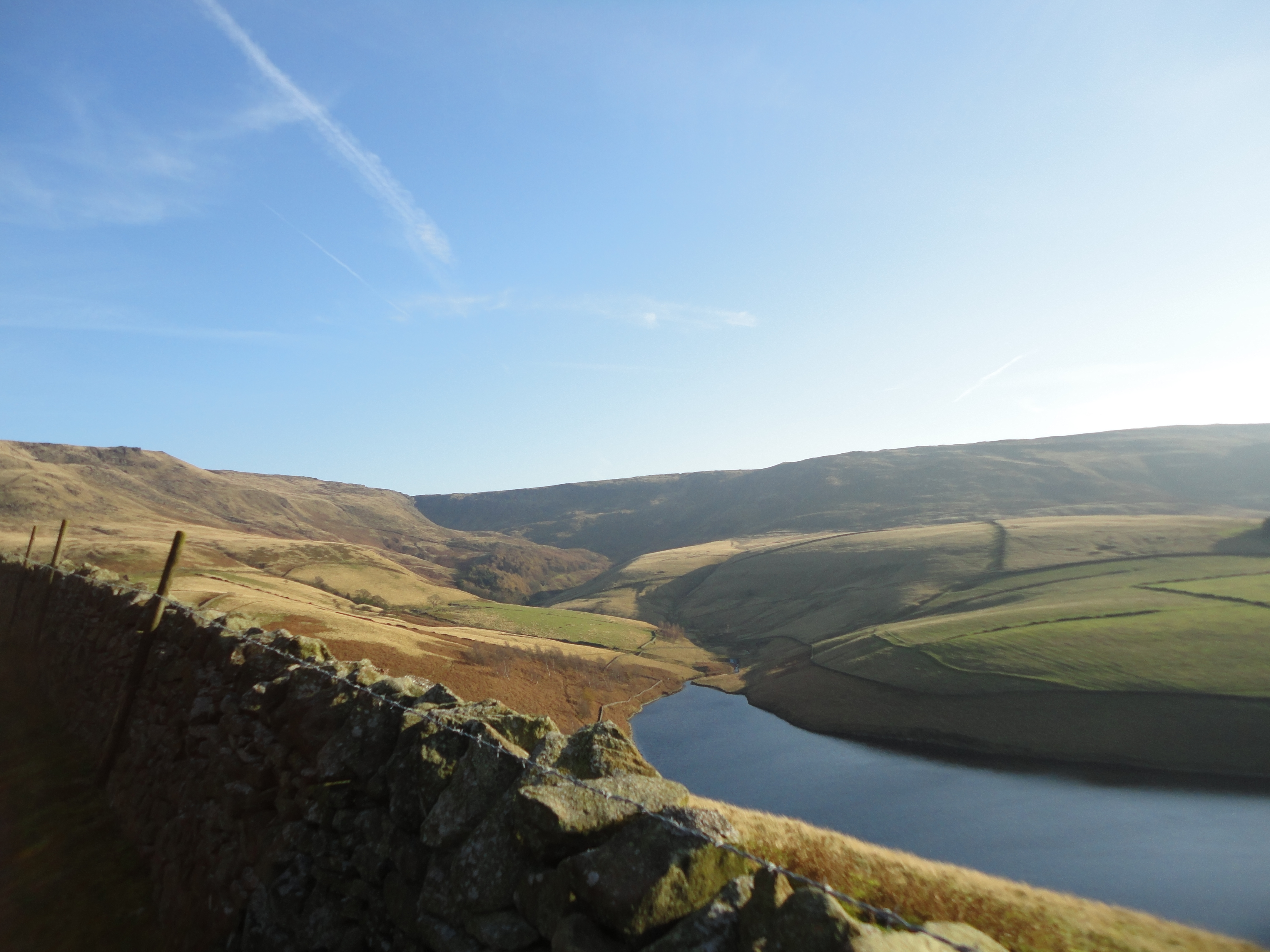
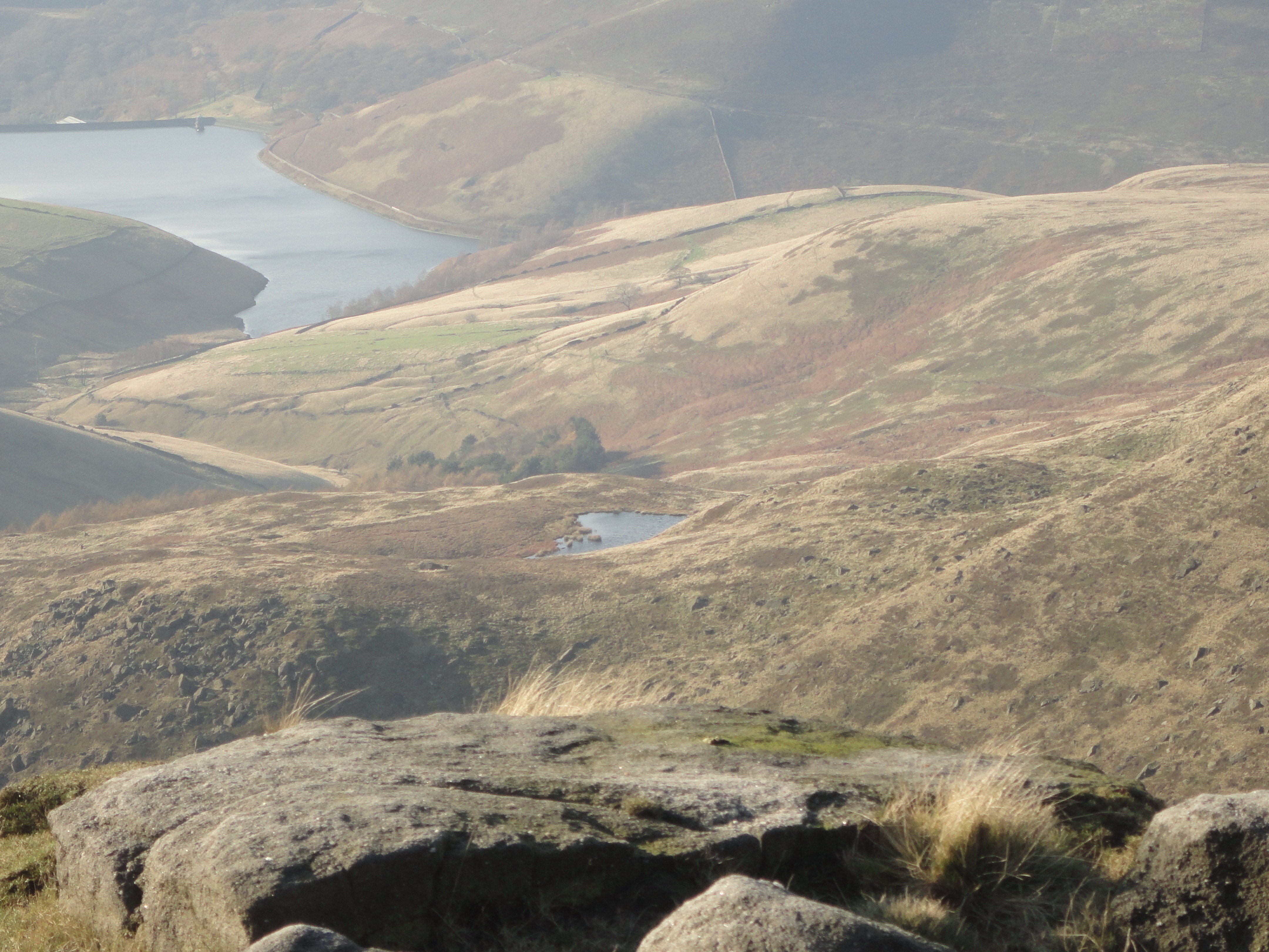
Kinder reservoir
The path leads along the slopes above the reservoir and takes you onto William Clough, a very pleasant path up a gentle ravine, which ascends steadily until you merge with the Pennine Way at Ashop Head. Turn right and follow the path up for a short, steep-ish climb onto the edge of the Kinder plateau at Sandy Heys.
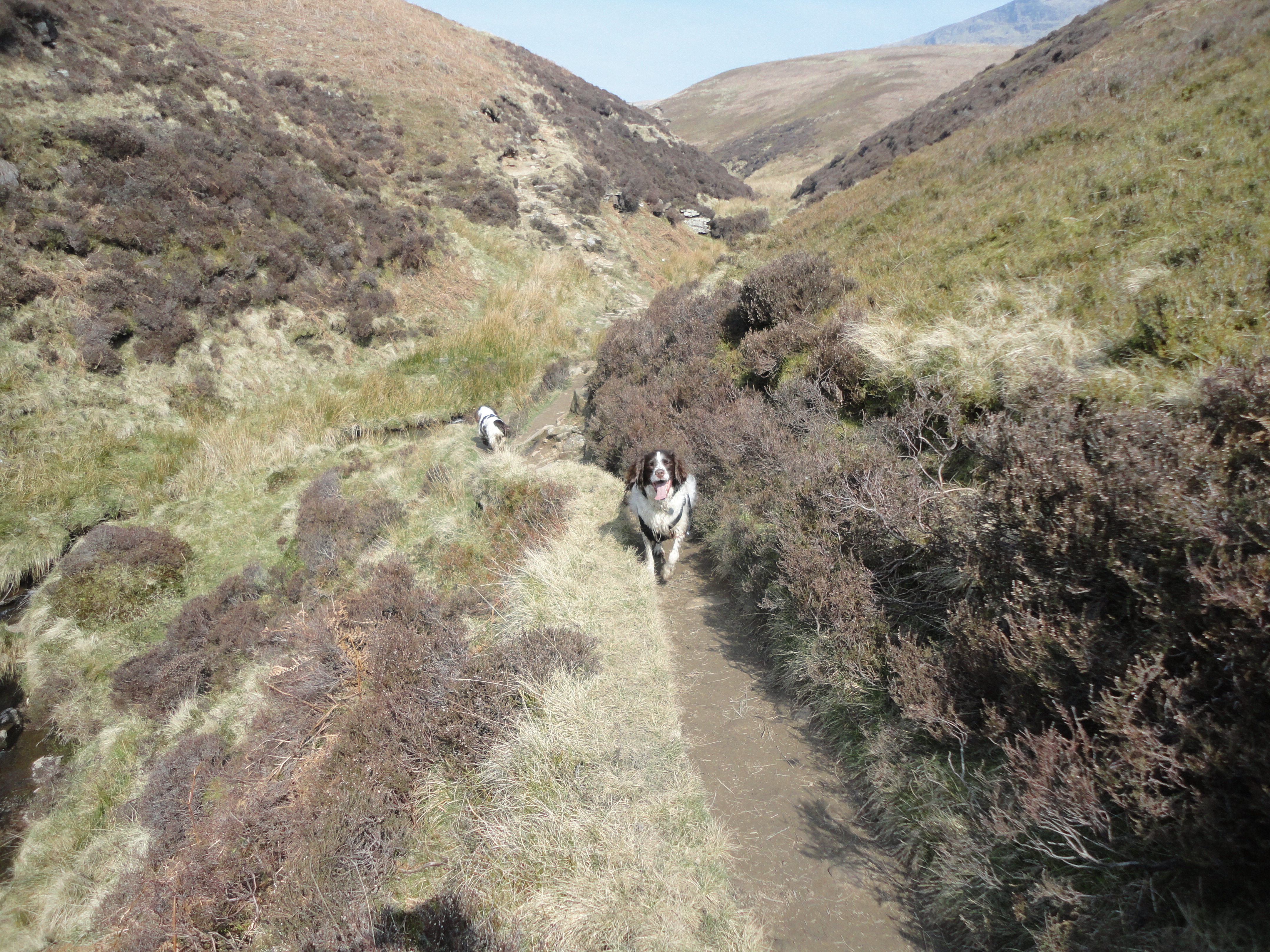
William Clough
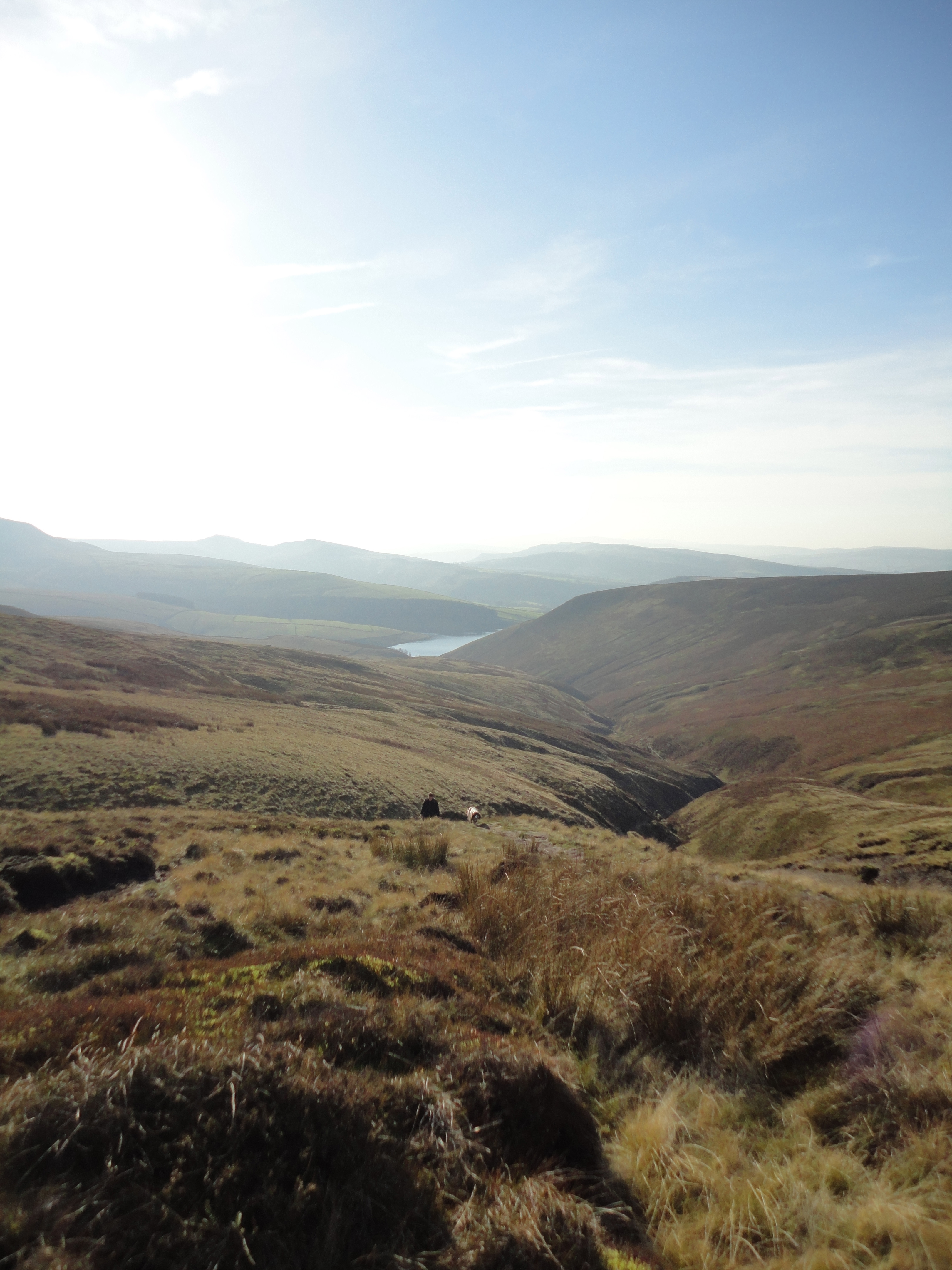
View back down William Clough to the reservoir
Walk round the edge for about a mile and a half. This is very easy walking along a good path threading between gritstone formations, with views of the reservoir below and beyond. You will soon reach Kinder Downfall, the highest waterfall in the Peak District, where the river Kinder spills over the plateau down a tumble of gritstone rocks to the reservoir. Whilst not perhaps the most spectacular torrent on the planet, it looks impressive on a blustery day, when the water seems to blow back up on itself. The banks of the river make a good place to stop for lunch.
Kinder Downfall
From here, you can also see the mysterious Mermaid’s Pool, shrouded in nebulous tales of a nymph who appears on Easter’s Eve to either grant immortality or lure men to their doom. It’s not an obvious spot for a mermaid, being a good fifty miles from the coast, and the legends are unclear as to whether she lures her victims to a nearby cavern or tavern, making a clear case for typographical accuracy if ever there was one. Here is a cheery poem by Henry Kirke telling the tale of a hapless shepherd’s boy who met his end at her hands.
Reservoir and the Mermaid’s pool from Kinder Downfall
After lunch, cross the river and carry on along the path for another couple of miles or so until you reach the trig point at Kinder Low, set amidst a peaty, somewhat alien landscape with its quasi-lunar rocky outcrops. Here you have good views of the southern ridges and yet more gritstone formations. From this point, my navigation becomes even more sketchy, but basically you carry on in roughly the same direction, keeping to the left of the rocks, until you reach a paved path which takes you past what I think is Noe Stool to a crossroads with the paths leading up from Jacob’s ladder/Upper Booth/Edale. Turn right through a gate, and follow the pony track for a while, passing the medieval Edale cross.
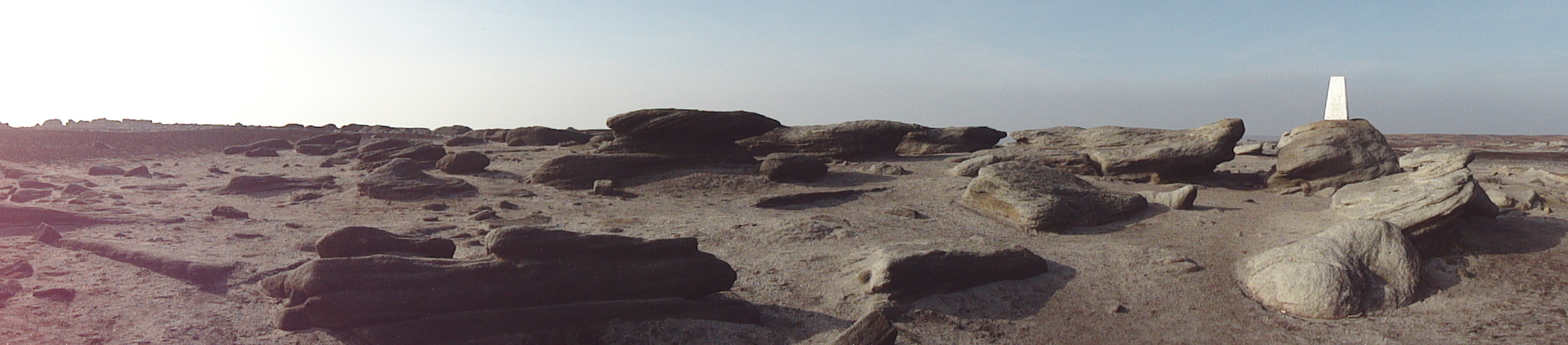
Kinder Low
Edale cross
Kinderlow end
From here, there are various routes back into the village. The last time we did it, we took the path signed off to the right to Hayfield via Tunstead Cross. This takes you along the hillside and, if you bear right where it forks, under Kinderlow end, eventually bearing off downhill through several fields to Tunstead farm. From here you follow the path, which becomes a road, back to Kinder Road and the Bowden Bridge car park, from where you can bear left to continue back into Hayfield.
There are various places where you can take refreshment, in particular the Sportsman on Kinder road if you can’t make it back to the village without a restorative shandy or two, or outside the Royal on a hot day.
All in all, depending on where you start and finish, the walk is about 8-10 miles and I would allow a good 6 hours for it.
(Disclaimer: this route description is written by a woman who relies heavily on her mobile navigation app, and is not intended as a substitute for a good map and a compass, and the knowledge of how to use them – none of which I had, which is all well and good on a fine day, but potentially disastrous in more typical High Peak weather).

A real hike beautifully described with some smashing photos.